Share Serpentine Townsite Local Structure Plan on FacebookShare Serpentine Townsite Local Structure Plan on X (formerly Twitter)Share Serpentine Townsite Local Structure Plan on LinkedinEmail Serpentine Townsite Local Structure Plan link
Consultation has concluded and a decision has been made.
Outcome
At its meeting in May 2021, Council recommended that the WA Planning Commission approves the Serpentine Townsite Local Structure Plan subject to modifications.
To view the Council decision, visit the Shire's Agenda and Minutes pageand view the May Council Meeting Minutes.
Background
The Draft Structure Plan was originally publicly advertised between 13 March 2014 and 4 April 2014 for comment. Council considered the Draft Structure Plan at the Ordinary Council Meeting held on 7 December 2015 and made a recommendation to the WAPC to support the Draft Structure Plan subject to modifications. The Draft Structure Plan was considered by the Statutory Planning Committee (SPC) of the WAPC on 30 January 2018. The WAPC required a number of modifications to be made to the Draft Structure Plan and for the modified Draft Structure Plan to be re-advertised for a period of 28 days. These modifications were extensive, and required a number of additional studies to inform revisions to reflect the WAPC interim decisions. The key modifications required by the WAPC included:
• The Residential R10 coding being removed and replaced with Residential R5.
• The Rudall Street Public Open Space being revised.
• The Local Water Management Strategy and Public Open Space Schedule being updated.
• A Bushfire Management Plan being prepared.
• A Wetland Assessment and Site-Specific Wetland Buffer Study being prepared.
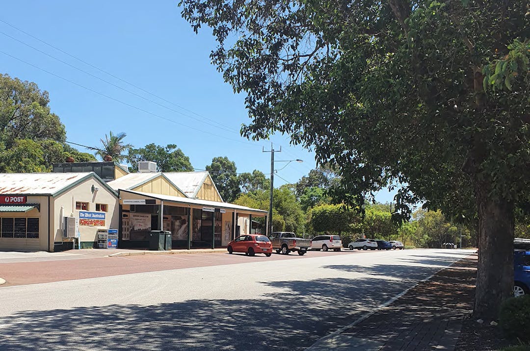
The Shire has undertaken all the modifications required by the WAPC and has now been re-advertised with he modified Draft Structure Plan. The modified Draft Structure Plan identifies land for the purposes of Residential R5, Neighbourhood Centre, public open space, public and community purpose and education. The Draft Structure Plan area has an approximate potential lot yield of 368 lots.
How can I comment
The public comment period has now closed.
Consultation has concluded and a decision has been made.
Outcome
At its meeting in May 2021, Council recommended that the WA Planning Commission approves the Serpentine Townsite Local Structure Plan subject to modifications.
To view the Council decision, visit the Shire's Agenda and Minutes pageand view the May Council Meeting Minutes.
Background
The Draft Structure Plan was originally publicly advertised between 13 March 2014 and 4 April 2014 for comment. Council considered the Draft Structure Plan at the Ordinary Council Meeting held on 7 December 2015 and made a recommendation to the WAPC to support the Draft Structure Plan subject to modifications. The Draft Structure Plan was considered by the Statutory Planning Committee (SPC) of the WAPC on 30 January 2018. The WAPC required a number of modifications to be made to the Draft Structure Plan and for the modified Draft Structure Plan to be re-advertised for a period of 28 days. These modifications were extensive, and required a number of additional studies to inform revisions to reflect the WAPC interim decisions. The key modifications required by the WAPC included:
• The Residential R10 coding being removed and replaced with Residential R5.
• The Rudall Street Public Open Space being revised.
• The Local Water Management Strategy and Public Open Space Schedule being updated.
• A Bushfire Management Plan being prepared.
• A Wetland Assessment and Site-Specific Wetland Buffer Study being prepared.
The Shire has undertaken all the modifications required by the WAPC and has now been re-advertised with he modified Draft Structure Plan. The modified Draft Structure Plan identifies land for the purposes of Residential R5, Neighbourhood Centre, public open space, public and community purpose and education. The Draft Structure Plan area has an approximate potential lot yield of 368 lots.
Share There has been a lot of rumours about the development of a sports and recreation facility on the corne of SW Highway and Keirnan. We live on this corner, directly behind the old couch house. We are very concerned about increased traffic and noise due to development and the ongoing noise and traffic once it is built, including privacy issues. We are also concerned about the beautiful, well established trees being felled which are a food source and habitat for the shires endangered cockatoos and other bird life. Could someone please give us some definitive answers on when this development will begin and if there is a plan and map of the proposed new area we can view. thank you :) on FacebookShare There has been a lot of rumours about the development of a sports and recreation facility on the corne of SW Highway and Keirnan. We live on this corner, directly behind the old couch house. We are very concerned about increased traffic and noise due to development and the ongoing noise and traffic once it is built, including privacy issues. We are also concerned about the beautiful, well established trees being felled which are a food source and habitat for the shires endangered cockatoos and other bird life. Could someone please give us some definitive answers on when this development will begin and if there is a plan and map of the proposed new area we can view. thank you :) on X (formerly Twitter)Share There has been a lot of rumours about the development of a sports and recreation facility on the corne of SW Highway and Keirnan. We live on this corner, directly behind the old couch house. We are very concerned about increased traffic and noise due to development and the ongoing noise and traffic once it is built, including privacy issues. We are also concerned about the beautiful, well established trees being felled which are a food source and habitat for the shires endangered cockatoos and other bird life. Could someone please give us some definitive answers on when this development will begin and if there is a plan and map of the proposed new area we can view. thank you :) on LinkedinEmail There has been a lot of rumours about the development of a sports and recreation facility on the corne of SW Highway and Keirnan. We live on this corner, directly behind the old couch house. We are very concerned about increased traffic and noise due to development and the ongoing noise and traffic once it is built, including privacy issues. We are also concerned about the beautiful, well established trees being felled which are a food source and habitat for the shires endangered cockatoos and other bird life. Could someone please give us some definitive answers on when this development will begin and if there is a plan and map of the proposed new area we can view. thank you :) link
There has been a lot of rumours about the development of a sports and recreation facility on the corne of SW Highway and Keirnan. We live on this corner, directly behind the old couch house. We are very concerned about increased traffic and noise due to development and the ongoing noise and traffic once it is built, including privacy issues. We are also concerned about the beautiful, well established trees being felled which are a food source and habitat for the shires endangered cockatoos and other bird life. Could someone please give us some definitive answers on when this development will begin and if there is a plan and map of the proposed new area we can view. thank you :)
On the project page is background information about the Keirnan Park project, key dates and documents including the Business Case report and final Masterplan. If you still have questions, please contact the Shire on 9526 1111 and ask to speak with the project engineer Reza Safaei.
Share The change to R5, what impact does that have on the CWA Serpentine and Districts branch? on FacebookShare The change to R5, what impact does that have on the CWA Serpentine and Districts branch? on X (formerly Twitter)Share The change to R5, what impact does that have on the CWA Serpentine and Districts branch? on LinkedinEmail The change to R5, what impact does that have on the CWA Serpentine and Districts branch? link
The change to R5, what impact does that have on the CWA Serpentine and Districts branch?
Jill Murphy
asked
over 5 years ago
Hi Jill,
The CWA Serpentine and Districts branch has been identified as Residential R5. This will not affect the current use of the property. A submission can be made on the Local Structure Plan to outline the current use of the property and any future aspirations for the site.
Share The Bush Forever covers two of the main access roads in the plan. One covers Richardson street from Karnup heading towards Mundijong and the other on Hall rd between Tonkin and Leslie.
Is this a mistake on the draft or are you planning on closing these parts of the roads? on FacebookShare The Bush Forever covers two of the main access roads in the plan. One covers Richardson street from Karnup heading towards Mundijong and the other on Hall rd between Tonkin and Leslie.
Is this a mistake on the draft or are you planning on closing these parts of the roads? on X (formerly Twitter)Share The Bush Forever covers two of the main access roads in the plan. One covers Richardson street from Karnup heading towards Mundijong and the other on Hall rd between Tonkin and Leslie.
Is this a mistake on the draft or are you planning on closing these parts of the roads? on LinkedinEmail The Bush Forever covers two of the main access roads in the plan. One covers Richardson street from Karnup heading towards Mundijong and the other on Hall rd between Tonkin and Leslie.
Is this a mistake on the draft or are you planning on closing these parts of the roads? link
The Bush Forever covers two of the main access roads in the plan. One covers Richardson street from Karnup heading towards Mundijong and the other on Hall rd between Tonkin and Leslie.
Is this a mistake on the draft or are you planning on closing these parts of the roads?
Abie Harrison
asked
over 5 years ago
Hi Abie,
Bush Forever areas are identified under the Metropolitan Region Scheme to protect and manage regionally significant bushland. A Bush Forever designation can occur over a road reserve. These parts of road with the Bush Forever designation are not proposed to be closed.
Share Hi,
I have reviewed your proposal and struggle to identify what in the proposal differs from the current zone and usage. I live on Maxwell street, could you please explain exactly what is new and or different in this proposal.
Thank you in advance. on FacebookShare Hi,
I have reviewed your proposal and struggle to identify what in the proposal differs from the current zone and usage. I live on Maxwell street, could you please explain exactly what is new and or different in this proposal.
Thank you in advance. on X (formerly Twitter)Share Hi,
I have reviewed your proposal and struggle to identify what in the proposal differs from the current zone and usage. I live on Maxwell street, could you please explain exactly what is new and or different in this proposal.
Thank you in advance. on LinkedinEmail Hi,
I have reviewed your proposal and struggle to identify what in the proposal differs from the current zone and usage. I live on Maxwell street, could you please explain exactly what is new and or different in this proposal.
Thank you in advance. link
Hi,
I have reviewed your proposal and struggle to identify what in the proposal differs from the current zone and usage. I live on Maxwell street, could you please explain exactly what is new and or different in this proposal.
Thank you in advance.
EmilyBerry
asked
over 5 years ago
Hi EmilyBerry,
The revised Serpentine Townsite Local Structure Plan which is currently being advertised includes the following key changes from the previous version.
All Residential land within the plan is identified as Residential R5. This means that lots may be able to be subdivided to a minimum of 2,000m2, subject to a subdivision application and relevant supporting information. If lots are already 2,000m2 or below, further subdivision will not be supported.
Some changes to the road layout within the plan.
Some changes to the amount and location of public open space within the plan.
Serpentine Townsite Local Structure Plan has finished this stage
Consultation for this project commenced on 28 January 2021 and closes at 5pm, 24 February 2021.
Under Review
Serpentine Townsite Local Structure Plan has finished this stage
Contributions to this consultation are closed for evaluation and review. The project team will report back on key outcomes.
Council consideration
Serpentine Townsite Local Structure Plan has finished this stage
The Serpentine Townsite Local Structure Plan was considered by Council at the May Ordinary Council Meeting and recommended to the Western Australian Planning Commission to approve the Structure Plan, subject to modifications.
Western Australian Planning Commission
Serpentine Townsite Local Structure Plan is currently at this stage
The Structure Plan is now with the Western Australian Planning Commission for determination.